Cameroon political
The vector map of Cameroon political offers a detailed representation of this Central African nation, located between latitudes 1° and 13° N and longitudes 8° and 16° E. It highlights key geographical features, including major cities like Yaoundé and Douala, as well as the Wouri River and borders with countries such as Nigeria and Chad.
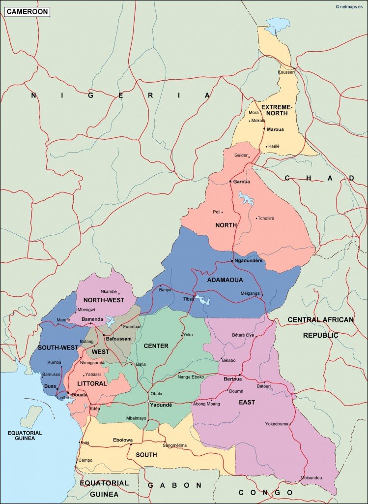
Available in versatile digital formats like EPS and AI Illustrator, this vector map comes with fully editable layers, allowing users to customize colors, labels, and borders. This functionality makes it an ideal resource for designers, educators, and planners.
Upon purchase, you’ll benefit from instant delivery via WeTransfer or email, ensuring that you can start working with the map right away.
Additionally, the vector map of Cameroon includes full reproduction rights, making it an attractive option for clients in over 140 countries who need high-quality, editable geographical graphics.