Ghana climate
The vector map of Ghana’s climate provides an insightful look into this West African country, located between latitudes 4° and 11° N and longitudes 3° and 1° W. Bordered by Côte d'Ivoire to the west, Burkina Faso to the north, and Togo to the east, Ghana features cities like Accra and Kumasi, along with vital rivers such as the Volta. This geography is crucial for understanding the local climate patterns.
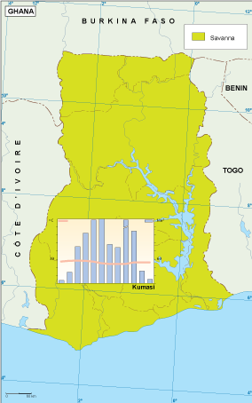
Available in versatile digital formats including EPS and AI Illustrator, the vector map of Ghana's climate comes with fully editable layers, allowing designers and researchers to customize the map easily. These formats ensure compatibility with various design software, making it perfect for any project.
Upon purchase, users benefit from an instant download via WeTransfer and email, simplifying access to your vector map. This convenient delivery method ensures you can start leveraging the map in your work without delay.
Clients from over 140 countries enjoy full reproduction rights with the vector map, allowing for unlimited use across educational, commercial, and personal projects. This broad availability means you can confidently showcase accurate climate data of Ghana in various applications.