Angola population
Angola, located in Southern Africa, is bordered by the Atlantic Ocean to the west and shares borders with Namibia to the south, Zambia to the east, and the Democratic Republic of the Congo to the north. The country's geographical coordinates are approximately 12°S latitude and 18°E longitude. Key points of interest include the capital city, Luanda, the mighty Zambezi River, and stunning natural landscapes that showcase the diverse regions of Angola.
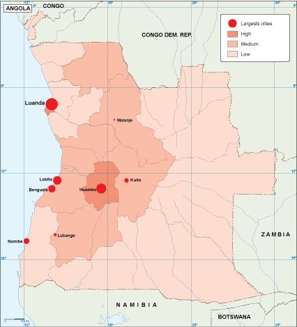
Our vector map of Angola population is available in popular digital formats like EPS and AI Illustrator, making it easy for users to incorporate into their projects. With fully editable layers, this map allows for convenient customization to suit your specific needs, whether for presentations, reports, or educational materials.
Upon purchase, you can enjoy the advantage of instant download via WeTransfer or email, ensuring you get your vector map of Angola population quickly and efficiently. This user-friendly delivery method simplifies access, so you can focus on your work without delay.
Included with your purchase are full reproduction rights, allowing you to use the vector map across various mediums. With clients in over 140 countries, our high-quality maps are trusted worldwide, making them a valuable asset for researchers, educators, and professionals alike.