Nigeria climate
Nigeria, located in West Africa, is the most populous country on the continent, bordered by Benin, Niger, Chad, and Cameroon. The diverse geography boasts notable features such as the Niger River, which runs through several major cities like Lagos and Abuja. Understanding Nigeria's climate is crucial for various sectors, including agriculture and tourism.
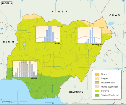
Our vector map of Nigeria's climate is available in digital formats, including EPS and AI Illustrator, ensuring seamless integration into your projects. Each layer of the map is fully editable, allowing users to customize the presentation of climate zones and data.
Once you purchase the vector map, expect an instant download via WeTransfer or email, streamlining your workflow and saving you time. This efficient delivery method ensures you have immediate access to the resources you need.
Clients across over 140 countries benefit from full reproduction rights with our maps, empowering them to use the Nigeria climate vector map freely in their projects. Invest in this essential tool to enhance your work today.