Libya climate
The vector map of Libya's climate offers an insightful view of this North African country, strategically located at coordinates 25.0° N latitude and 17.0° E longitude. Encompassing key geographical features, the map highlights significant cities like Tripoli and Benghazi, major rivers such as the Wadi al-Ajal, and the country's borders with Tunisia, Algeria, Niger, Chad, Sudan, and Egypt. This detailed mapping is essential for understanding Libya's diverse climatic zones.
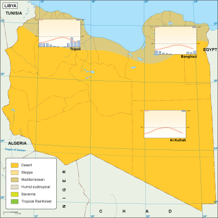
Available in versatile digital formats like EPS and AI Illustrator, the vector map includes fully editable layers. This allows users to customize the visual elements to meet specific project requirements easily. Designers and researchers will find the adaptability of this map ideally suited for varied applications in climate studies and geographic analysis.
Upon purchase, clients can enjoy an instant download via WeTransfer or email, ensuring swift access to the Libya climate vector map. This convenient delivery method makes it easy to start projects without delay, maximizing efficiency for professionals in various fields.
With full reproduction rights included, this vector map is available for clients in over 140 countries. This extensive reach underscores the map's utility for diverse applications, from academic research to marketing campaigns, ensuring that users can leverage high-quality, accurate data in