Rennes
Rennes, a vibrant city located in the northwestern part of France, serves as the capital of the Brittany region. Positioned at the coordinates 48.1118° N latitude and 1.6819° W longitude, Rennes is bordered by the Vilaine River, which adds to its scenic beauty. Its urban layout showcases key landmarks and points of interest, making it an essential destination for tourists and researchers alike.
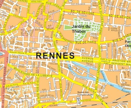
The vector map of Rennes is available in popular digital formats, including EPS and AI Illustrator. This ensures that users can easily access fully editable layers, allowing for seamless customization and integration into various design projects. Whether you’re a cartographer or an urban planner, the map’s high-quality format meets your professional needs.
Upon purchasing the vector map, clients can enjoy instant delivery through WeTransfer or email, ensuring quick access to essential resources. This efficient method allows users to start their projects immediately, without delays associated with traditional shipping methods.
With full reproduction rights included, this vector map of Rennes is a valuable asset for clients across over 140 countries. The flexibility to use the map in various applications makes it an ideal choice for businesses, educators, and creatives looking to enhance their work with accurate geographical visuals.