Sudan political
The vector map of Sudan political provides an intricate representation of this northeastern African nation, highlighting its geographical features and political boundaries. Located at coordinates 15.5000° N latitude and 32.5852° E longitude, Sudan is bordered by Egypt to the north, the Red Sea to the east, and South Sudan to the south. Key landmarks include the capital city, Khartoum, where the Blue Nile and White Nile converge, emphasizing Sudan's rich cultural and historical significance.
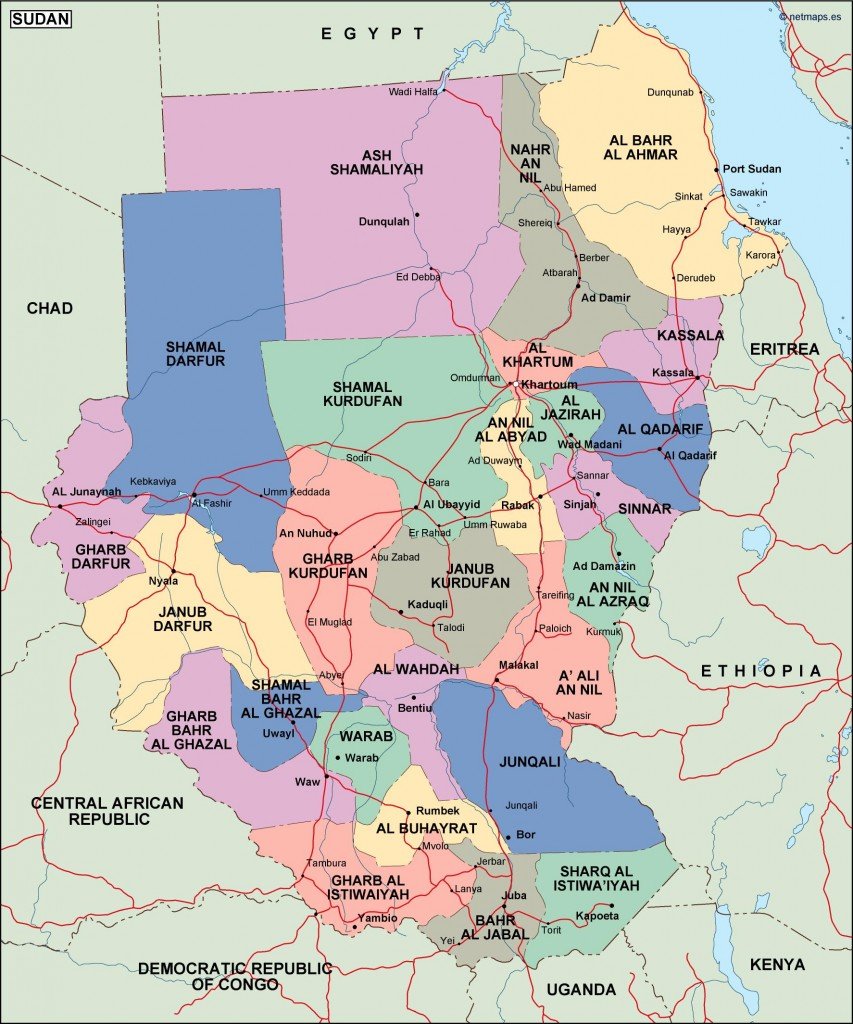
Available in digital vector formats such as EPS and AI Illustrator, this vector map of Sudan political is designed with fully editable layers, allowing users to customize the map to suit their specific needs. Whether for educational, marketing, or personal projects, the detailed elements make it a versatile tool for designers and professionals alike.
Upon purchasing, customers can enjoy instant access via WeTransfer or email, ensuring a seamless download experience. This immediate delivery process allows you to start using the vector map of Sudan political without delay, perfect for urgent projects or presentations.
With full reproduction rights included, this vector map is suitable for clients across over 140 countries. No restrictions mean you can utilize the map commercially or personally without worry, making it a valuable asset for anyone needing reliable geographic representations of Sudan.