Lesotho political
Lesotho, a landlocked country located in Southern Africa, is characterized by its diverse geography, bordered entirely by South Africa. Positioned at approximately 29.5° S latitude and 28.5° E longitude, Lesotho features key cities like Maseru, the capital, and significant rivers such as the Caledon. This vibrant nation is known for its mountainous terrain, making its political vector map an essential tool for understanding its administrative boundaries and regional divisions.
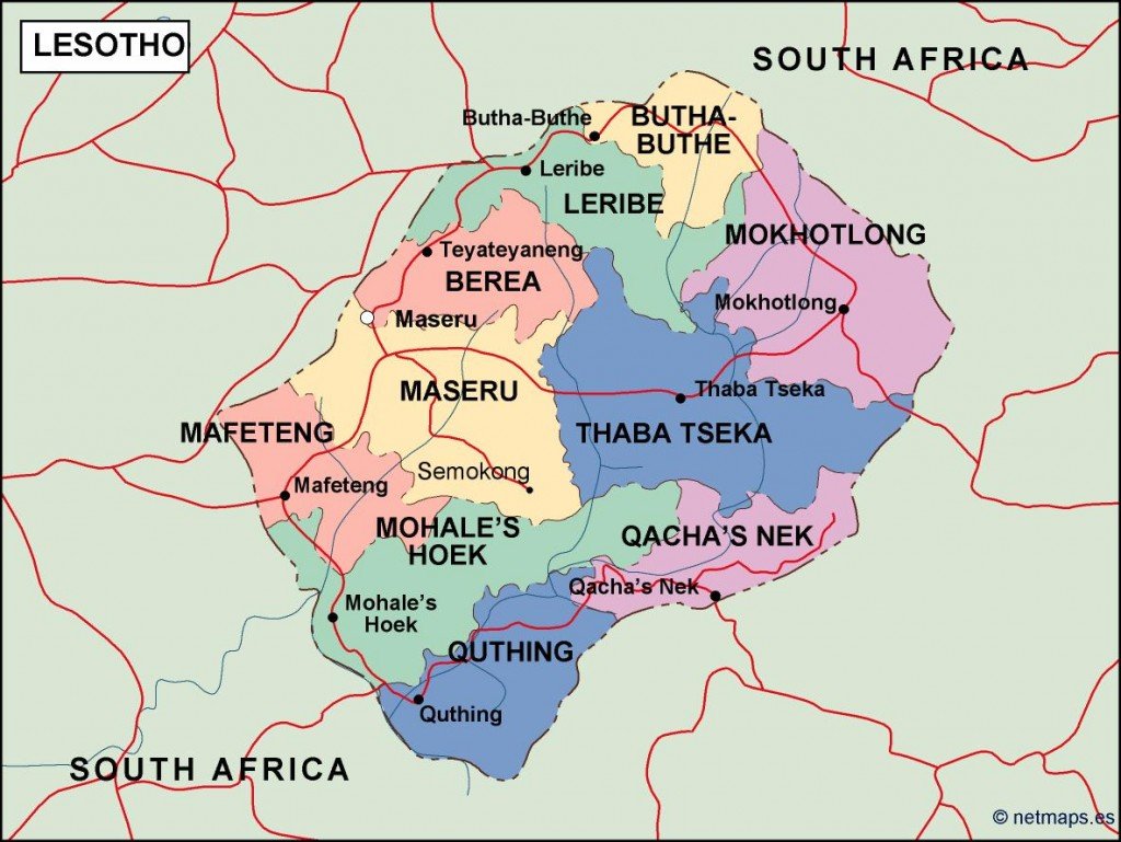
The digital vector map of Lesotho's political landscape is available in multiple formats, including EPS and AI Illustrator. These formats ensure that users have fully editable layers, allowing for customization and integration into various design projects. With high-quality graphics, this map is ideal for professionals seeking precision and clarity.
Upon purchase, clients can enjoy the convenience of instant delivery via WeTransfer and email. This efficient service ensures that you receive the vector map of Lesotho's political borders promptly, enabling immediate use in your projects or presentations.
Our clients benefit from full reproduction rights, making this vector map an attractive option for businesses and individuals alike. With satisfied customers in over 140 countries, this Lesotho political vector map is trusted worldwide, exemplifying quality and accessibility in digital mapping solutions.