Mapa tierra del fuego 2025-12-06 18:00:30
Explore the captivating geography of the Mapa Tierra del Fuego, a stunning vector map showcasing the southernmost region of Argentina and Chile. This unique area, located at approximately 54°S latitude and 67°W longitude, features significant landmarks such as the vibrant city of Ushuaia, the Beagle Channel, and picturesque rivers like the Río Grande.
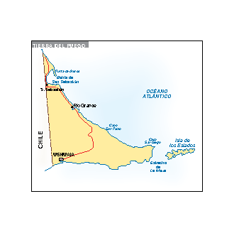
Our Mapa Tierra del Fuego is available in versatile digital formats, including EPS and AI Illustrator. With fully editable layers, customizing this map to suit your specific project needs is a breeze.
Enjoy the convenience of instant delivery! The Mapa Tierra del Fuego will be sent directly to your email or via WeTransfer, ensuring you can start your project without delay.
Rest assured, with every purchase, you receive full reproduction rights, allowing you to use the map freely. Join satisfied clients from over 140 countries and elevate your work with this exceptional vector map.