Madagascar transportation
Madagascar, the fourth largest island in the world, is strategically located off the southeast coast of Africa, with coordinates approximately 20.0° S latitude and 47.0° E longitude. This vibrant country is home to significant cities like Antananarivo, the capital, and vital transportation routes including rivers like the Tsiribihina. Key borders surround the island, influencing its trade and transport dynamics within the region.
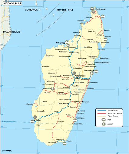
Our Madagascar transportation vector map is available in versatile digital formats, including EPS and AI Illustrator. Each file is meticulously crafted with fully editable layers, empowering you to modify and customize elements to suit your specific projects. Seamlessly integrate this comprehensive mapping tool into your design workflow.
Instantly access your Madagascar transportation vector map with convenient delivery options via WeTransfer or direct email. Our efficient system ensures you receive your map promptly, enabling you to kickstart your projects without delays.
With full reproduction rights included, our vector maps cater to clients in over 140 countries, ensuring you can utilize the Madagascar transportation map for commercial or personal endeavors. Unlock the potential of your projects with our expertly designed resources!