Mapa tierra del fuego 2025-12-09 00:00:22
The vector map of Mapa Tierra del Fuego provides a detailed representation of this unique region located at the southern tip of Chile and Argentina. Known for its stunning landscapes and diverse ecosystems, it includes major cities like Ushuaia, the southernmost city in the world. With coordinates approximately 54°S latitude and 68°W longitude, the map captures essential features such as the Beagle Channel and borders shared with neighboring islands, making it a vital resource for geography enthusiasts.
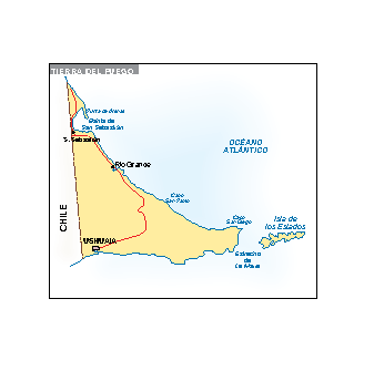
Available in digital vector formats like EPS and AI Illustrator, the Mapa Tierra del Fuego is ideal for designers and cartographers alike. Its fully editable layers allow users to customize features easily, enabling a tailored presentation that meets specific project needs. Whether you're creating presentations, educational materials, or artistic representations, this map adapts effortlessly.
Upon purchase, the Mapa Tierra del Fuego is conveniently delivered through instant download via WeTransfer and email, ensuring you receive your file promptly. Enjoy the flexibility of immediate access to this high-quality vector map, which is perfect for both professional use and personal projects.
With full reproduction rights included, the Mapa Tierra del Fuego serves clients in over 140 countries worldwide. This means you can use the map without worrying about licensing issues