Madrid city
The vector map of Madrid city is a precise representation of Spain's vibrant capital, located in the center of the country within the region of Madrid. The city's coordinates are approximately 40.4168° N latitude and 3.7038° W longitude, showcasing important landmarks such as the Manzanares River and its boundaries. This detailed mapping resource offers invaluable insights for urban planning, navigation, and tourism.
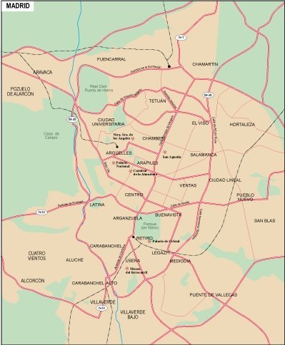
Available in versatile digital vector formats like EPS and AI Illustrator, this Madrid city map features fully editable layers, allowing users to customize details to fit their specific needs. Whether you're a designer, urban planner, or educator, the flexibility of this vector format makes it a practical choice for a range of projects.
Upon purchase, the vector map can be quickly downloaded via WeTransfer or directly through email, ensuring you have immediate access to this essential resource. No waiting times, just instant access to help you visualize Madrid in stunning detail.
With full reproduction rights included, clients from over 140 countries trust this vector map for their projects. Whether you’re creating promotional materials or planning urban developments, you can confidently utilize this map of Madrid city for commercial or personal use without any restrictions.