Botswana climate
Botswana, located in Southern Africa, is known for its diverse climate, ranging from arid to semi-arid regions. Situated between latitudes 17° and 27° South and longitudes 20° and 30° East, this landlocked country shares borders with Namibia, South Africa, and Zimbabwe. Key geographic features include the Okavango River and vibrant cities like Gaborone, providing essential insights for a detailed vector map of Botswana’s climate.
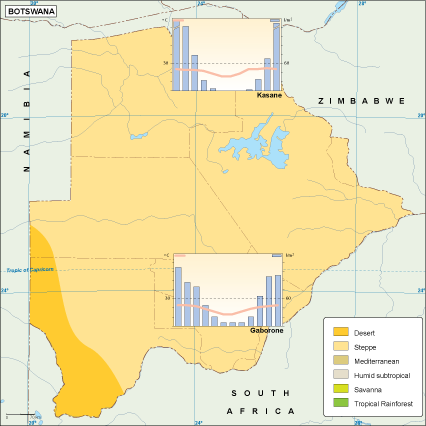
The vector map of Botswana's climate is available in multiple formats, including high-quality digital EPS and AI Illustrator files. Featuring fully editable layers, this map allows for easy customization, enabling users to tailor the information according to their specific needs.
Upon purchase, the vector map can be instantly downloaded via WeTransfer or sent directly through email, providing immediate access to critical climate data. This rapid delivery ensures efficiency for professionals requiring timely information for projects.
With full reproduction rights included, clients from over 140 countries benefit from unlimited possibilities in utilizing this vector map of Botswana’s climate. Enhance your projects with this essential resource that meets diverse educational and professional needs while ensuring global accessibility.