Cape verde political
Cape Verde, an archipelago located off the northwest coast of Africa, consists of 10 volcanic islands in the Atlantic Ocean, roughly at coordinates 16.5381° N latitude and 24.2517° W longitude. Key points include its capital, Praia, located on Santiago Island, and the unique geography shaped by its mountainous terrain and sandy beaches. The islands are separated by narrow waters, and there are no rivers, enhancing their distinct landscapes.
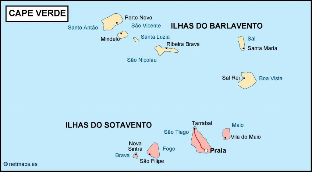
Our vector map of Cape Verde in political format is available in versatile digital formats like EPS and AI Illustrator, allowing for seamless integration into various design projects. Each layer is fully editable, ensuring that you can customize borders, cities, and labels as per your requirements effortlessly.
For your convenience, our vector map can be delivered instantly via WeTransfer and email, saving you time and allowing immediate access to your assets. This quick delivery ensures you're never without the essential tools for your projects.
Clients from over 140 countries enjoy full reproduction rights with our Cape Verde political vector map. Perfect for academics, educators, and businesses, this map is designed for comprehensive use, enabling you to share, publish or create without restrictions.