Comores transportation
The vector map of Comores transportation highlights the geographical features of the archipelago, located in the Indian Ocean between Madagascar and the African mainland. With coordinates around 12.2° S latitude and 44.4° E longitude, the map showcases key points like the capital city, Moroni, and vital transport routes connecting the islands, providing insights for geography enthusiasts and researchers alike.
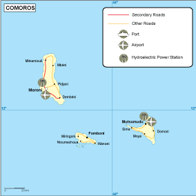
Available in digital vector formats such as EPS and AI Illustrator, this fully editable map allows for customization to meet various project requirements. The editable layers enable seamless incorporation into existing design projects, making it an invaluable asset for professionals in cartography, education, and urban planning.
Upon purchase, clients can enjoy instant delivery via WeTransfer and email, ensuring quick access to the vector map of Comores transportation. This efficient delivery method caters to those who need immediate solutions for their projects.
With full reproduction rights included, clients benefit from the peace of mind that comes with owning a versatile resource. Our services have extended to over 140 countries, underscoring the global appeal and utility of the vector map.