Croatia economic
Croatia, located in Southeast Europe along the Adriatic Sea, is bordered by Slovenia, Hungary, Serbia, Montenegro, and Bosnia and Herzegovina. Its geographical coordinates are approximately 45.1° N latitude and 15.2° E longitude. Key points of interest include cities like Zagreb, Split, and Dubrovnik, as well as significant rivers such as the Sava and Drava. The Croatia economic vector map captures this vibrant region, highlighting vital transportation routes and economic hubs.
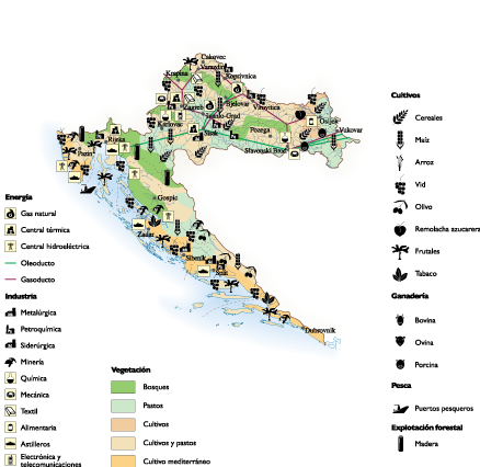
This digital vector map of Croatia is available in versatile formats like EPS and AI Illustrator, allowing for full customization and easy integration into various projects. With fully editable layers, users can modify essential elements to suit their specific needs, making it an invaluable resource for designers and analysts alike.
Upon purchase, enjoy instant delivery of your Croatia economic vector map via WeTransfer and email, ensuring you receive your files quickly and efficiently. This seamless process allows for immediate access to your essential mapping data without delay.
By obtaining this vector map, you secure full reproduction rights, enabling usage across multiple platforms. With clients spanning over 140 countries, our quality and service are trusted worldwide for all your Croatia economic mapping needs.