Egypt vegetation
Egypt, located in northeastern Africa, is bordered by the Mediterranean Sea to the north and the Red Sea to the east. The country features diverse geography, including the Nile River, which flows through its capital, Cairo, and nourishes its surrounding vegetation. The coordinates of Egypt span approximately 26°N to 31°N latitude and 25°E to 35°E longitude, highlighting key cities, rivers, and regions that showcase the rich plant life across deserts and fertile lands.
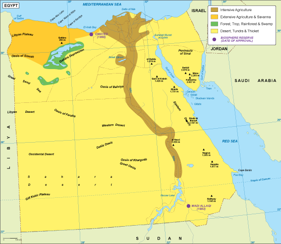
Our vector map of Egypt vegetation is available in multiple digital formats, including EPS and AI Illustrator, allowing for easy integration into your projects. With fully editable layers, you can customize this map to suit your specific needs, making it an essential tool for designers, educators, and researchers interested in Egypt's unique ecological characteristics.
Delivery of your vector map is quick and efficient, with instant downloads facilitated through WeTransfer and email. This seamless process ensures that you can access and start using your map without delay, perfect for time-sensitive projects or presentations.
Clients across over 140 countries enjoy full reproduction rights for our vector maps, ensuring you can use the Egypt vegetation map without restrictions. This comprehensive licensing gives you the freedom to create, innovate, and share your work, making it