Mapa santa fe
The vector map of Mapa Santa Fe showcases a detailed geographical representation of Santa Fe, located in Argentina, within the northeastern region of the country. Its coordinates are approximately 31.6340° S latitude and 60.7037° W longitude. Key geographic features include the city of Santa Fe, the influential Salado River, and its proximity to the Parana River, placing it as a vital ecological and commercial area bordering other provinces.
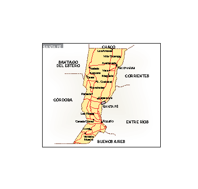
Available in high-quality digital vector formats such as EPS and AI Illustrator, the Mapa Santa Fe offers fully editable layers that allow for seamless customization. Users can manipulate features, colors, and labels effortlessly to fit their specific needs.
Instant download is made easy through WeTransfer and email delivery, ensuring that your Mapa Santa Fe is just a click away. This convenient access means no waiting and immediate availability for your projects.
Clients enjoy full reproduction rights with their purchase, making this resource invaluable for businesses and individuals in over 140 countries. The Mapa Santa Fe is perfect for presentations, educational materials, and geographic analyses.