Nicaragua political
Nicaragua, located in Central America, is bordered by Honduras to the north and Costa Rica to the south. It boasts coordinates of approximately 13.0° N latitude and 85.0° W longitude. The nation features key geographical points, including the capital city of Managua, the stunning Lake Nicaragua, and the beautiful San Juan River, which flows along its southern border. The vector map of Nicaragua political prominently showcases these significant landmarks and administrative boundaries.
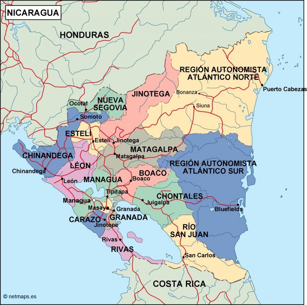
Available in digital vector formats like EPS and AI Illustrator, the Nicaragua political map is fully editable with separate layers for easy customization. This allows designers and cartographers to adapt the map to their specific needs, enhancing their projects with an accurate representation of Nicaragua’s political landscape.
Clients can conveniently receive their Nicaragua political vector map through an instant download via WeTransfer or email, ensuring quick access to the resource. This streamlined delivery method helps professionals efficiently integrate valuable geographical information into their work without delay.
Purchase of this vector map grants clients full reproduction rights, making it an ideal choice for businesses and organizations in over 140 countries. Whether for publication, education, or personal use, the editable Nicaragua political map provides the flexibility and compliance necessary for diverse applications.