Nigeria political
Nigeria is situated in West Africa, bordered by Benin to the west, Niger to the north, and Cameroon to the east. Its geographical coordinates are approximately 9°N latitude and 8°E longitude, making it a central hub in the region. Key cities include Abuja, the capital, as well as Lagos and Port Harcourt, while notable rivers like the Niger and Benue enhance its topography.
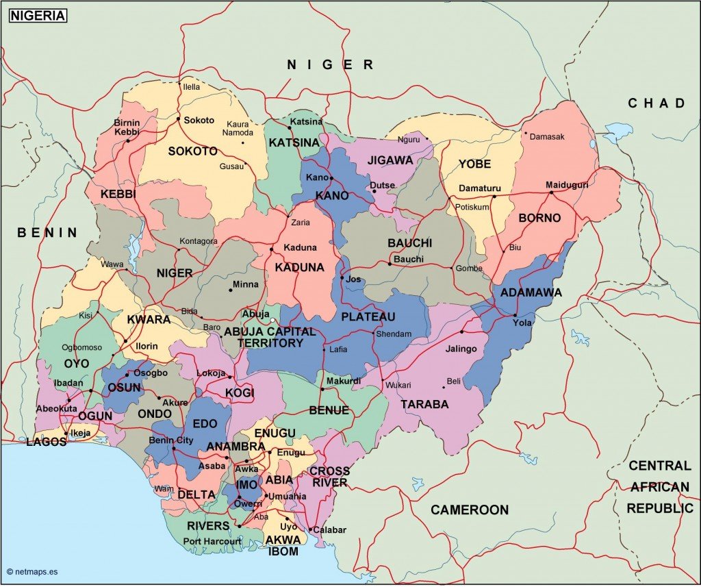
Our Nigeria political vector map is available in popular digital formats such as EPS and AI Illustrator, ensuring full compatibility for your design projects. The map features fully editable layers, allowing for customization to meet your specific needs.
You can enjoy instant access to the Nigeria vector map with secure downloads via WeTransfer and email, simplifying the process of obtaining your geographical resources.
Rest assured that purchasing this map grants you full reproduction rights, making it suitable for commercial use. We proudly serve clients in over 140 countries, showcasing the global demand for our high-quality vector maps.