Norway land use
Norway, located in Northern Europe, is known for its stunning landscapes and diverse land use patterns. The country stretches from the northern Arctic Circle down to the southern coastline, with key geographic features including the majestic fjords, the capital city of Oslo, and significant rivers like the Glomma and Drammenselva. The vector map of Norway's land use offers precise details, making it invaluable for professionals and researchers exploring regional dynamics.
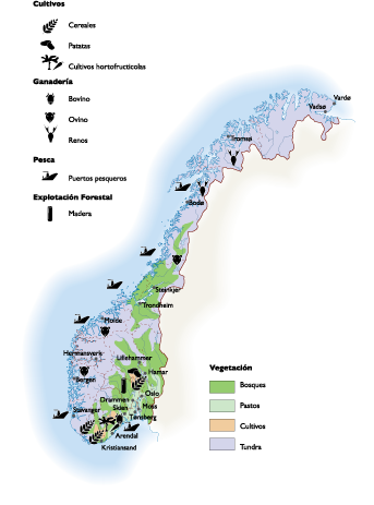
This vector map is available in popular digital formats, including EPS and Adobe Illustrator (AI), ensuring easy access and usability. With fully editable layers, users can customize the map according to their specific needs, facilitating high-quality presentations and analyses.
Enjoy the convenience of instant delivery with our vector map, available via WeTransfer and email. This streamlined process ensures you receive your digital assets quickly, allowing for immediate use in your projects.
Our vector map of Norway includes full reproduction rights, empowering clients from over 140 countries to utilize it in a variety of applications. Enhance your work with this customizable and versatile land use map of Norway!