Poland population
Poland is situated in Central Europe, bordered by Germany to the west, Ukraine to the east, and the Baltic Sea to the north. Its geographical coordinates are approximately 52° N latitude and 20° E longitude. Key features of the country include vibrant cities such as Warsaw, Kraków, and Gdańsk, alongside major rivers like the Vistula and Oder. The diversity of its landscape contributes to a dynamic population distribution.
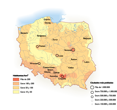
For those seeking a vector map of Poland's population, our product is available in digital formats including EPS and AI Illustrator files. Each file contains fully editable layers, making it easy to customize for various projects, whether for academic, commercial, or personal use.
Our vector map is delivered instantly through WeTransfer or directly via email, ensuring you have access to your files without any delay. This convenient service allows you to start your project right away, enhancing productivity.
Customers from over 140 countries enjoy full reproduction rights with our vector map, providing the freedom to use the design for a wide range of applications. With our easy-to-use Illustrator files, you can effectively showcase Poland's population data in any project.