Argentina mapa sector primario
Discover the intricate details of the "Argentina mapa sector primario," a vector map that captures the diverse geography of Argentina. Located in South America, Argentina is bordered by the Andes Mountains to the west and the Atlantic Ocean to the east, stretching from latitude 22°S to 55°S. Key cities such as Buenos Aires, the Atlantic coastline, and significant rivers like the Paraná are showcased, making it an invaluable resource for geographical and educational purposes.
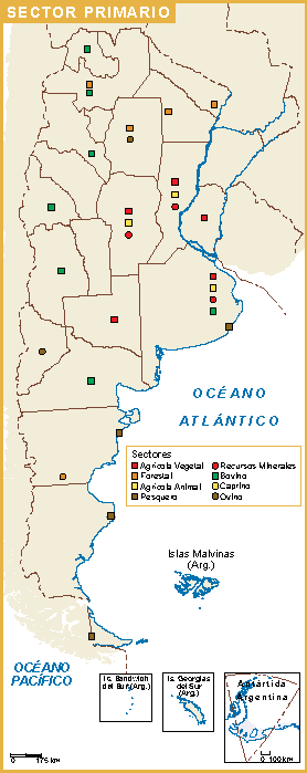
Our vector map is available in multiple formats, including digital vector EPS and AI Illustrator files. With fully editable layers, users can customize the map to fit their specific needs, enhancing presentations or projects with ease. The high-quality graphics ensure that every detail is crisp and clear, perfect for professional use.
Delivery is a breeze with our instant download options via WeTransfer and email. After purchase, you’ll receive the map quickly and efficiently, enabling you to start your project without delay. This convenient service makes accessing your materials straightforward and fast.
With full reproduction rights included, this vector map is a valuable asset for clients across over 140 countries. Whether you’re a designer, educator, or business professional, the "Argentina mapa sector primario" is designed for versatile use, making it a reliable choice for