Mozambique climate
The vector map of Mozambique climate showcases the country’s unique geography, located on the southeastern coast of Africa. Mozambique is bordered by the Indian Ocean to the east, with vibrant cities such as Maputo and essential rivers like the Zambezi flowing through its landscape. The coordinates of Mozambique highlight its rich biodiversity, making it a vital region for climate study and environmental research.
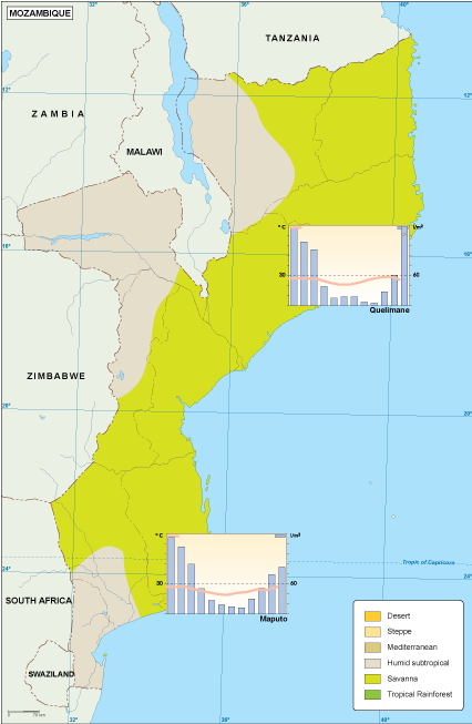
Available in digital vector formats like EPS and AI Illustrator, this map is designed for ease of use with fully editable layers. Users can customize the map according to their specific needs, making it a perfect tool for researchers, educators, and graphic designers interested in Mozambique's climatic conditions.
Upon purchase, customers can enjoy instant download via WeTransfer and email, ensuring quick access to this essential resource. The seamless delivery process allows for immediate integration into various projects.
With full reproduction rights included, clients in over 140 countries can confidently utilize this vector map of Mozambique climate in commercial and educational materials. Its versatility and accessibility make it an invaluable asset for climate-related initiatives worldwide.