Brasil mapa energia
The vector map of 'Brasil mapa energia' presents an intricate representation of Brazil's geography, highlighting its vast landscapes and key features. Located in South America, Brazil is bordered by ten countries and offers stunning geological diversity, including the Amazon River, which is the longest river in South America. The coordinates for Brazil are approximately 14.2350° S latitude and 51.9253° W longitude, showcasing its expansive area, vibrant cities like São Paulo and Rio de Janeiro, and rich environmental resources.
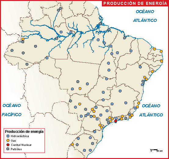
Available in versatile formats such as digital vector EPS and AI Illustrator, this map ensures users can work seamlessly with fully editable layers. Professionals, designers, and educators benefit greatly from the high resolution and clarity that these formats offer, making it easy to manipulate areas of interest or add specific data to the map.
For convenience, the 'Brasil mapa energia' vector map can be delivered instantly via WeTransfer or email, providing clients with quick access to essential materials. This prompt delivery system allows creative projects to maintain momentum without delays, catering to the fast-paced needs of today's clients.
With full reproduction rights included, users can confidently utilize the 'Brasil mapa energia' in various applications without concern for restrictions. Our services extend globally, with satisfied clients in over 140