Zambia transportation
Zambia is a landlocked country in Southern Africa, bordered by eight nations and located at coordinates 15° S latitude and 30° E longitude. Known for its stunning landscapes, Zambia's transportation network connects key points like Lusaka, its capital city, the Zambezi River, and borders with neighboring countries such as Zimbabwe and Malawi. The vector map of Zambia transportation provides a detailed overview of this essential infrastructure, making it a vital tool for planners and developers.
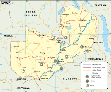
Available in digital vector formats such as EPS and AI Illustrator, this Zambia transportation map features fully editable layers that allow users to customize the design according to their needs. This versatility makes it an invaluable resource for urban planners, cartographers, and businesses seeking precise geographic information.
Upon purchase, clients can enjoy the convenience of instant downloads via WeTransfer and email, ensuring immediate access to the Zambia transportation vector map. This seamless delivery process caters to diverse use cases, enhancing user experience and satisfaction.
With full reproduction rights included, clients in over 140 countries can utilize the vector map without restrictions. This ensures that professionals can confidently use the map for commercial projects, presentations, and educational purposes, maximizing its potential for global applications.