Benin
Benin, located in West Africa, lies between Nigeria to the east and Togo to the west, with coordinates approximately 9°N latitude and 2°E longitude. This vibrant country showcases key geographical features, including the bustling city of Cotonou and the majestic Ouémé River, which flows through its heart. The vector map of Benin highlights borders, urban centers, and important landmarks, making it an essential tool for geographers and designers.
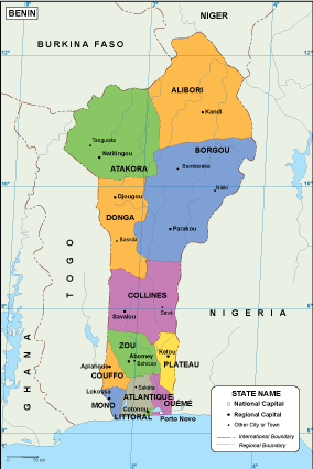
The vector map of Benin is available in versatile digital formats, including EPS and AI for Illustrator, ensuring that users have fully editable layers. These formats allow easy customization, making them perfect for creating engaging presentations or detailed cartographic analyses.
We offer instant download of the vector map via WeTransfer or email, streamlining your access and ensuring you can begin your project immediately. This efficient delivery system enhances the user experience, making it convenient for professionals and enthusiasts alike.
Clients from over 140 countries enjoy full reproduction rights with our vector map of Benin, empowering them to use it in various applications without restrictions. This valuable resource is ideal for educational, commercial, or personal projects, ensuring you have the flexibility needed to showcase your work effectively.