Congo transportation
The vector map of Congo transportation provides a comprehensive overview of this central African nation, located just south of the equator at coordinates 4° S latitude and 15° E longitude. Key geographical features include the Congo River, one of the longest rivers in the world, and important cities like Kinshasa, the capital, which is situated on the northern bank, adjacent to the border with the Republic of the Congo.
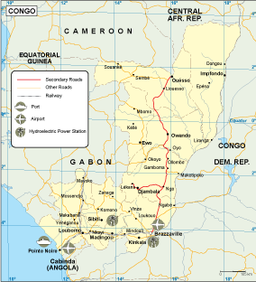
Available in digital formats such as EPS and AI Illustrator, this vector map is designed for convenience and versatility. Each layer is fully editable in vector graphics software, allowing users to customize elements of the transportation network according to their needs, whether for academic, commercial, or personal use.
Upon purchase, clients receive instant access to the file through WeTransfer and email, ensuring a seamless experience. This efficient delivery method guarantees that you can begin working on your projects without delay.
With full reproduction rights included, this vector map serves clients in over 140 countries, underscoring its global appeal and utility. Users can confidently integrate this high-quality resource into their designs, knowing it meets international standards for clarity and detail.