Croatia population
Croatia, located in Southeast Europe along the Adriatic Sea, is a country rich in geography and culture. It is bordered by Slovenia to the northwest, Hungary to the northeast, Serbia to the east, and Bosnia and Herzegovina to the southeast. Key cities such as Zagreb, the capital, and major rivers like the Sava and Drava enhance its appeal. The country’s coordinates are approximately 45.1° N latitude and 15.2° E longitude, making it a geographically strategic hub between Western and Eastern Europe.
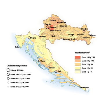
Our vector map of Croatia population is available in versatile digital formats, including EPS and Adobe Illustrator (AI). This fully editable map offers customizable layers, allowing you to manipulate features according to your project needs. It’s an essential tool for designers, researchers, and educators looking to create informative graphics.
Delivery of the vector map is seamless, with instant download options available through WeTransfer or via email. Simply complete your purchase, and your map will be at your fingertips almost immediately. Enjoy the convenience of accessing high-quality geographic data effortlessly, ready to enhance your work.
Clients in over 140 countries can enjoy full reproduction rights with our Croatia population vector map. This means you can confidently use, modify, and distribute the map