Mapa tierra del fuego
The vector map of Mapa Tierra del Fuego captures the stunning geography of this unique region located at the southern tip of South America, shared by Chile and Argentina. With coordinates approximately 54°S latitude and 68°W longitude, it highlights key points such as the vibrant city of Ushuaia, the Beagle Channel, and the breathtaking landscapes that define the area’s natural beauty.
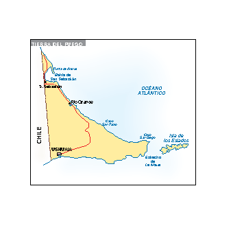
Available in multiple formats including digital vector EPS and AI Illustrator files, this map features fully editable layers, allowing for customization to suit your specific needs. The vector format ensures high-resolution quality suitable for both print and digital applications, making it a versatile tool for designers and cartographers.
Upon purchase, enjoy the convenience of instant download via WeTransfer and email, enabling immediate access to your vector map. This quick delivery system ensures you can start your projects without delay.
With full reproduction rights included, our vector map of Mapa Tierra del Fuego is available to clients across over 140 countries. This comprehensive license grants you the freedom to use the map in various applications, enhancing your creative endeavors while ensuring compliance with copyright regulations.