Nigeria vegetation
Nigeria, located in West Africa, is renowned for its diverse vegetation spanning various ecological zones. Its coordinates are approximately 10.0° N latitude and 8.0° E longitude, making it a unique blend of tropical rainforests, savannas, and mangroves. Key geographical features include the Niger River, which runs through the country, and major cities like Abuja and Lagos, positioned near borders with Benin and Cameroon.
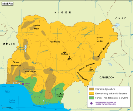
Our vector map of Nigeria's vegetation is available in digital formats, including EPS and AI Illustrator. Each map comes with fully editable layers, allowing users to customize, manipulate, and enhance the illustrations to perfectly suit their project needs. This level of flexibility is essential for graphic designers and environmental planners alike.
Delivery is hassle-free and efficient, providing instant download through WeTransfer or email. This ensures that you have immediate access to the vector map of Nigeria's vegetation, ready for your creative projects.
With full reproduction rights included, our clients enjoy complete freedom to use the map across diverse applications. Our customer base spans over 140 countries, showcasing the universal appeal and utility of this expertly crafted vector map.