Somalia population
The vector map of Somalia population is an essential resource for geographers, urban planners, and researchers. Located in the Horn of Africa, Somalia is bordered by the Indian Ocean to the east and shares land borders with Ethiopia and Djibouti. Major cities like Mogadishu and Hargeisa, along with vital features such as the Shabelle River, are accurately depicted in detailed layers, highlighting key demographics and geographical nuances.
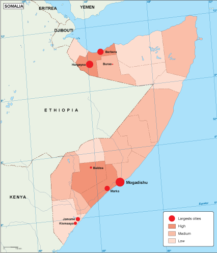
Available in digital vector formats like EPS and AI Illustrator, this map ensures ease of use with fully editable layers. Users can customize the map to suit their specific needs, whether for academic projects or business presentations, making it an invaluable tool for data visualization.
Delivery of the vector map is seamless, featuring instant downloads via WeTransfer and email. This efficient system allows you to access your map quickly and start working with it immediately.
With full reproduction rights included, clients enjoy the flexibility to use the Somalia population vector map in various applications across over 140 countries. This comprehensive licensing enhances the value of the resource for diverse international projects and initiatives.