Togo climate
Togo is a West African country located along the Gulf of Guinea, positioned between Ghana and Benin, with coordinates approximately 8.6195° N latitude and 0.8248° E longitude. This diverse nation features varied landscapes, from the coastal region with its vibrant cities like Lomé to the inland regions rich in rivers such as the Mono. Togo's borders and unique geographical features are clearly represented in the vector map of Togo climate, offering a comprehensive overview of its environmental diversity.
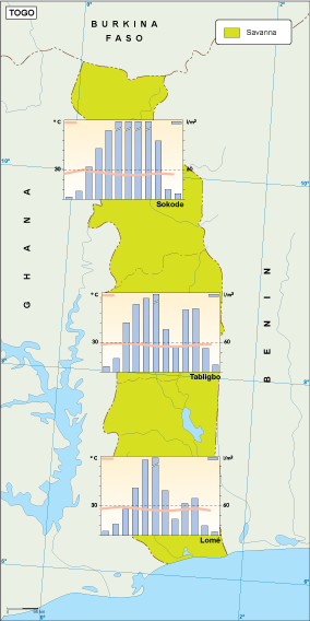
The vector map of Togo climate is available in versatile formats, including digital vector EPS and AI Illustrator files, ensuring compatibility with various design software. This fully editable map features organized layers, allowing users to manipulate and customize the visualization to suit their specific needs, making it an essential tool for professionals and educators alike.
For convenient access, the vector map of Togo climate can be instantly downloaded via WeTransfer or directly via email. This quick and efficient delivery method ensures that you have the resources you need at your fingertips, allowing for immediate use in presentations, reports, or educational materials.
Clients purchasing the vector map of Togo climate will receive full reproduction rights, enabling unlimited use in their projects. With satisfied customers in over 140 countries, this comprehensive