Togo physical
The vector map of Togo physical provides an accurate representation of this West African nation, highlighting its unique geography. Located between Ghana and Benin, Togo spans roughly 56,785 square kilometers, with coordinates at about 8.6195° N latitude and 0.8248° E longitude. Key geographical features include the capital city, Lomé, the serene Mono River, and borders that delineate its interaction with neighboring countries, making it essential for geographic studies and travel.
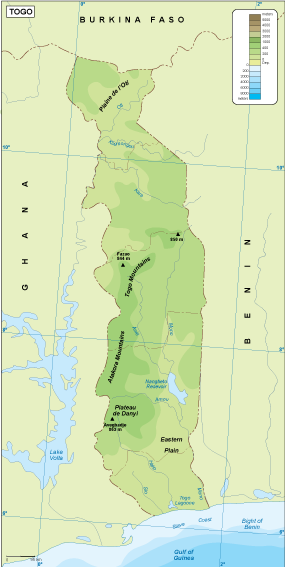
Available in versatile digital vector formats such as EPS and AI Illustrator, this map boasts fully editable layers that allow for easy customization. Users can modify elements to fit specific design needs while maintaining high-quality resolution, making it ideal for educational materials or professional presentations.
Upon purchase, the vector map of Togo physical is delivered instantly via WeTransfer and email, ensuring immediate access to important resources. This efficient delivery method allows users to start working with the map without delay, facilitating quick project turnaround.
By acquiring this vector map, clients enjoy full reproduction rights, enabling multiple usage opportunities across different platforms. With satisfied customers in over 140 countries, this map has proven to be a valuable tool for educators, businesses, and content creators worldwide looking to enhance their projects with detailed geographic information