Eritrea economic
The vector map of Eritrea’s economy showcases its strategic location in the Horn of Africa, bordered by Sudan to the west, and Djibouti and Ethiopia to the south. Key geographic features include the capital city, Asmara, and vital rivers such as the Barka and Anseba, which support the nation's agricultural needs. With coordinates approximately 15.6500° N latitude and 39.1667° E longitude, this region is rich in cultural and natural resources.
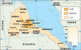
Available in versatile formats like digital vector EPS and AI Illustrator, this map boasts fully editable layers that allow users to customize their visual presentations effortlessly. Perfect for designers, policymakers, and geographers, it offers clarity and precision in illustrating economic data.
Upon purchase, you can access the vector map easily via instant download through WeTransfer or direct email delivery. This quick access ensures you can start your projects without delay and with the latest geographic data.
With full reproduction rights included, the vector map of Eritrea's economy is a valuable resource for clients in over 140 countries. Whether for academic, professional, or personal use, this map serves to effectively communicate critical economic insights tailored to your specific needs.