Togo vegetation
Togo, a small West African nation located between Ghana and Benin, boasts diverse vegetation across its geographical landscape. Nestled between latitudes 6° and 11° N, and longitudes 0.5° and 1.2° E, Togo features lush forests, savannas, and notable geographical points like the capital, Lomé, and vital waterways such as the Mono River, enhancing its ecological richness.
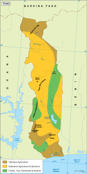
Our vector map of Togo's vegetation is available in popular digital formats, including EPS and AI Illustrator, ensuring compatibility with various design software. The map includes fully editable layers, allowing you to customize and adapt the visual representation of Togo's unique flora to suit your project's needs.
You can access the vector map through instant downloads via WeTransfer and email, making it a seamless experience for designers and researchers. This efficient delivery method guarantees that you'll receive your materials quickly, ready for immediate use.
With full reproduction rights included, our vector map empowers clients in over 140 countries to utilize Togo's vegetation data without constraints. This comprehensive approach makes it an invaluable resource for educational, commercial, and artistic endeavors related to Togo's diverse ecosystems.